Friday, March 31, 2006

Aspiring Cook...

Yeah..."we'll see how much of that actually takes place" was a gr8 disclaimer...I've settled quite comfortably in Wanaka. I've been using it as a base for several tramps that pulled me into the wild. Mt. Cook Village is quite a drab little town with very little color, literally and figuratively, but the enormous mountain range that postures itself with confidence and class in the thundering background is a thing at which I could never tire myself looking. As you sit with a neck ache you feel yourself idolizing a 3 faced rock that has managed to crush itself to the astronomical altitude of 3700+ meters. I glance at it as I hitch, as I climb, as I scramble, as I munch, as I 4get myself and then a sound of thunder rolls through its glacial surroundings and I suddenly realize that there's an avalanche right before my eyes; ice spilling over a cliff that formed itself of the very descending element. There as common to hear as it is to see a cloud. As much as it sounds like the thunder that follows crack-bolt lighting in Wyoming it is only another of nature's wondrous processes that humbles you without your consent, then I bow my head in w8 4 the next vehicle.

I was actually at Mt. Cook twice; once just after having updated the blog and twice just recently. The first began with an intended trip to Queenstown for a couple days; I didn't even get out of the parking lot of the hostel before my mind was swiftly changed to head to Mt. Cook. An Israeli had a car and told me he was heading that way..."why not" I thought and threw my pack in his trunk, hit the grocery store and was off to 2 beautiful days of hiking up to Mueller Hut that sits so high up with gr8 views of mtns. from every angle. I scrambled up bolders to Mt. Ollivier and followed a ridge of jagged, exposed rock and pulled off the daypack to use for a pillow and just sat, soaked, and swam in solitude's silence with surrendered solace of the Southern Alps; the sun on my soul cradled my meager ascent.

I found my way back to Wanaka for St. Paddy's day where I had a few leisurely drinks. I recovered and then, with stunning weather, decided to do one of the hardest--or I should say most dangerous--(free climbing) saddles in New Zealand; Cascade Saddle. This saddle has stunning views of the Matukituki Valley and all the surrounding ranges. I set off hitching from the hostel and with luck found a ride in no time. Unfortunately, I was still going to be tardy in beginning my planned first day. Most people take 2 days to actually do the saddle, but I planned to do it in one...this was a bit problematic because I was compromised to "finding" a ride and so I couldn't begin at my most desired hour. This forced me to push past several people who tried to dissuade me from going over the top; I had to assure them with previous accomplishments and plain old stubborn americanism, careless that they might utter the infamous "Fucking Arrogant Americans..." I didn't care at this point. The reason most people go an easy 3 hours the first day is because the second day is 10-12 hours over a very demanding alpine pass. The pass isn't even the highest part--the pylon which commands a view unparalleled, truly--and leaves another 5-6 hours of descent upon rocky, unstable footing. I flew up to the pylon and due to my poor (but ever improving) map reading ability, journeyed up to an even higher peak and played about for 1/2 hour completely out of route; I couldn't afford this luxury at my l8 start time, but did anyway...the apple was the nutrious sweet I needed. I descended without problem to find that I hadn't even reached the saddle yet...the sun seemed to be closing over the Range. I had to pop off the shoes and cross a river (didn't want to be tramping in the dark with cold, wet feet) and move up and over. The saddle brought another treasure with the opening sight of Dart Glacier...magnificent! People were camping there and I moved quickly pass with a wave of my newfound stick. Darting down the Dart I wasn't really worried cuz I knew I had my headtorch; however, it was still quite a ways off even if I did manage my swift pace which I was admirably expressing. Dark overcame me an hour before I could even smell the swing bridge that allowed me access to the hut. I had to ford 3 rivers that had grown quite deep with quick currents due to the afternoon's glacial thaw. I walked up and down those rivers in the dark for much more time than normal and ended up leaping on to a several rocks that were sturdy enough to hold me...could've gone either way though. In the end, I can only owe my arrival to the hut at 9pm to my headtorch, the uncanny comment that was assuring advice from a random guy just as I set out, 7 hours earlier--as if he knew I would be lost along that river--to aqueous luck, nature, and that thing I like to associate with as my guardian angel. The truth is that it was all part of the same, but I was carried on wings without any doubt. I was a bit wet, bloody, but sooo relieved to hear voices and find a bed by that time. Sweet AS!!! The way out was a couple of days of walking in grasslands with mountains looming behind clouds, offering the omniscient perspective they always hold...gr8 2 days out. I arrived on the road towards Glenorchy, where they filmed a large part of "Lord of the Rings" and even found a crew filming 10km after I came out of Chinamans Bluff...at that point of my stumble onto civilized paths, I managed a ride from an old couple and was off to Glenorchy.

I rested my blistered, puffy, and disgusting feet for a few days. As I read in the solarium, a scot talked me into going over Ball Pass which is a glacier near Mt. Cook. I told him I hadn't walked with crampons or used an ice axe before, not to mention didn't have them, and he said it wouldn't be a problem. I hired/rented them and was in complete trust to his ability...not sure if it was entirely a prudent step, but I'm still writing this aren't I? The pass was flippin' fantastic beyond a dream. The first night up there--b4 we actually climbed to the pass--we nearly froze in an emergency shelter that lost way too much heat to the aluminum from which it was constructed. We set off with a big breakfast and hit the scrambled up the scree finding the glacier in no time. I donned my crampons and had a good go on a glacier for an hour. The pass wasn't technical at all and was very tame, easy, and safe as far as mountaineering is concerned. It was still humbling and offered real imagination every time we had to negotiate a large crevasse...they just dropped to the bottom of the earth...sooo far down that you don't know the state you'd reach should you ever land; BIG step over that there! It was super fun to walk up an ascent of 45 degrees of solid ice...stamping the teeth into the glacier for reassurance. It was a very long day but brought me into an alpine club's hut where I was told tales of "International Challenge" multi-day runs by a 39 yr. old female. I never again will complain of pain or perservance...this woman was the hard core galore of all athletes.

I managed to hitch out of Mt. Cook Village--again with difficulty--as an Irish family picked me up and drove me the entire way (though was out of their way) and told me stories of the work they did in Africa. I know that every story that passes my ears is something special that will be incorporated into the passion of occupation that I will someday encounter. There are really some amazingly beautiful people with the kindest spirits and intentions...you'd never have known...it's worth stopping to ponder that gr8ness and its existence in a world that we're constantly told is malicious...

Arriving AGAIN to Wanaka, I headed up an unknown hill to a house where I was invited to stay should I return. A mate I met at the hostel said the girls needed a bit of rent money--less per night for me, extra $ 4 them...everyone wins--and have been there ever since. I tried to hitch out to Mt. Aspiring Natl Park again to do a 3-4 day thing up towards Quarterdeck Glacier but didn't get picked up...that's right...I didn't get picked up. I couldn't believe that I had'nt the luck that had always shouldered me. When I got back to the house, I realized I didn't have my lighter (or any fire for that matter) and would've been pretty screwed had I gotten up there without anyone around to assist me in lighting my cooker. Who says things don't happen for a reason?!?

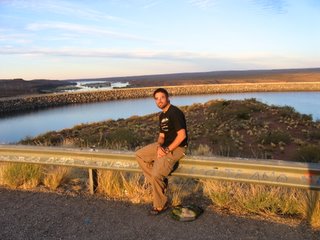
25 days remain for me in NZ and I have just a couple plans that have been scrapped, reassembled, and scrapped again...no telling where the road will lead me in the next period. I've assembled pictures in "Mt. Cook", "Cascade Saddle", and added some to "Wanaka"...enjoy. I've also since shaved my beard and am now less of a bearded bushman that might've scared you all away...there are pics of the beard somewhere in there as well.

I will say that Mt. Aspiring has been so unbelievably impressive over the past 3 weeks and that Mt. Cook has also been an experience that I shouldn't ever erase in my mind's fortress of comfort. The colors reflecting Lake Pukaki with Cook magnetising me to his altar, breaking the bushline above Aspiring Hut to not see, rather be among the very mountain peaks that I've shaken my head to over an unknown time...it all pushes me through the heaven to a place that one doesn't know unless s/he experiences it; I have.

Tuesday, March 07, 2006

Tramping about...

Quite a lot has happened in the last week...not to mention the last time I posted anything sexy. I'm just gonna skip all the update buz and take you away to the highlights and recap only that which might be read by those who might read.

I am a Tramp...er...probably the most unique thing to do in NZ is to tramp. Kiwis all around the 2 islands go out regardless of age and tramp around the country. As a quick 101 in NZ geology, the nation is right in a plate-tectonic collision. The north island has 2 plates under it that have moved one on top of the other which creates a load of geo-thermal activity; thus, Craters of the Moon, Volcanoes, etc. The south isle on the other hand, is on top of 2 plates that have collided, neither of which wants to give. So these 2 plates collide and push themselves up to astounding heights; thus, the awing alpine and famous Fiordlands.

I know what it's like to have been Adam...I think...walking through this valley (not of darkness) mesmorized by the verdant lows, the golden slopes, and the sculpted rock with snow dusted attics that dare you to climb and search for hidden treasures. I've just come from the easiest day walk that rewarded me 100-fold; Rob Roy's Glacier set into the cradling arms of Rob Roy's Peak and Mt. Alpha. The most incredible thing about the glaciers here (Franz Josef & Fox are much more popular, laden with tourists that climb upon them and swing ice axes into the already melting block or worse, helicopter up to the peak and walk around it for several hours...sure it must be a great experience, but I just find something wrong with rubbing salt into an already wounded eco...call me enviro-sensitive and I'll just tell you to piss off...where was I? Oh yeah) is that instead of dropping to the ice cold water it created, they move down to the warm quasi-tropical bushline. It's quite amazing to walk thru forest for hours only to come up to a massive sculpture of white. Looking up I see brilliant blues, literally glowing and calling to mind superman's home. A cascade is falling from the other side of it's arm; the surge of water plunges a meager 100ft before it transforms into a mist for another 15 ft, finally, converting into a bastion of ghosts that rush towards the carvings of holes their forefathers created and passed through. The sun descends to embrace the peak in between the kisses blown upon the clouds that pass over ever so often...the golden rays drip on the snow and form a priceless jewel that rests in between the beaming blue shaving...it gives the feeling of Christmas all over my body.
I walk down from the alter of adoration and pass across the swing bridge another hour later to find myself in the valley I was speaking of before. To walk in the cleavage of such glorious landscapes makes one breathe a bit faster. And you finally see what it means...the result of 2 rocks ferociously colliding in battle as the victorious one to lie on top is only swept away by incessant erosion; the tops of this historic feud are not unlike when one touches their lips to an ice-cream cone and purses them together quickly...they lop over, angled. Sheep and cattle gaze at me with blades of grass hanging from their chins...I think they're laughing.

Abel-Tasman was a lovely coast where I kayaked for a good day, took my pack out of the compartments and jaunt off upwards to a camping sight near a lovely beach. It's so fun to be in a tramp where you must wait on the moon to pull the water back for you to pass...like opening a curtain to another room. Low tide made way for me around 7am and I moved out towards another path...the kayaking was the highlight for me, but the beaches that struck me after several minutes of bushwalk shined like carribean candy.

Hitchhiking around NZ has been so bloody easy! I can get anywhere, and it makes for so much more of an interesting route. You really never know who's gonna take you nor for how long. Even if it's to get to the start of a tramp or the beginning of a day hike, I hitch...even for several miles cuz ya just never know what krazy kiwi will swoop ya up.

Tramp 101...what the hell is a tramp. Americans might call it trekking or hiking, but "that's not even close", I've been told by a kiwi. There are really 2 theories: 1) it's a combo of trekking and camping; thus, tramping. 2) and the more preferred is the idea of the older days when "tramps" would move about from city to city in any way that they could. They don't use the word tramp in a pejorative sense like we do in the states, rather just a roamer that would set off to the backwoods for days at a time. So now when people go tramping, they travel the paths/routes that those tramps made way back when and that DOC (Dept. of Conservation) have improved upon. A tramp is getting down and dirty for several days. It doesn't matter if there's mud, water, or any obstruction...ya just move on through it to see the beauty...it's actually sooooo refreshing and wonderful. Many of the orange arrows, that point the way) are applied to uprooted trees (from huge surges of water or massive wind gusts) or in Avalanche areas you find rock cairns (piles of rock that trampers agglomerate) and you move through. Bogs are...unpleasant surprises. You go to step on what looks like a normal stretch of earth or "at worst it's a lil' puddle" and you end up knee-deep in a mud hole, calling to yourself like a 17 year old boy who knows the consequences of what he's doing, but can't fight the sweet feeling, "pull out, pull out!!!" You manage to get it out...your foot...and you just walk around with muddy boots/socks the rest of the day...all part of the experience. I'm sure I've forgotten several things, but it's a 101 course...come down here and "do it yourself" for the second semester.

The first tramp I did was the Travers-Sabine and this was the first time I felt that I actually put my pack to good use. I mean I was out there on a 6 day tramp walking 80km of valley, alpine passes, and river crossings..."hellyeah!" I sped through most of the bush and ended up doing several side trips that really made my tramp more special than that which most others do. The first day took me up a steep mossy forest that was sooo magical. Really just a green carpeted floor, fuzzy, warm, and inviting; it was an enchanted forest in so many ways. I have video of it, but can't get that on the pic-site. The only part on green is parts of certain rocks and the path that so few have taken. Cupola Basin Hut is the best view in the entire Nelson Lakes Natl. Park, and the beautiful thing is that no one could really tell me anything about it when I was asking prior to setting off. I was so happy when I arrived to find such a rudimentary hut that slept so few and had so little that the more modern huts offer. Despite all the lack of luxury, the environs provided more jaw-dropping comfort than the Waldorf-Astoria could offer at any time. You walk out the door and less than 15 feet of grass from the door, the floor drops off into a massive chasm into which you can only hear water dropping, then you realize it rapidly rises to the massive slip that forms a crevasse into the mountains center. You stare up at this peak, with it's jagged edge, its stomach ostensibly torn from its origin and are left in terror imagining how anyone might get there, way up to that point, of the aptly named Mt. Hopeless. I recall once when I was going out to get my sweat-soaked shirt that I had layed in the sun to dry...I forgot about where I was. After I reached down to pull it from the rock, I turned my head to an angle and glanced up at the forgotten Mt. Hopeless...it was as if someone struck me in the face...I nearly jumped at it's presence...that feeling was what it is to be alive...I just knew it!

Most of the natural wonders down here have such appropriate names attached to them, and it does so much justice to giving you an idea of what it must have been like to poineer these parts before anyone knew anything about them. Desolation Creek, Mt. Awful, Mt. Hopeless, Mt. Dreadful, Roaring Billy Falls...it exudes a brooding a dark story of "once it happened". I moved down and around the valley where I encountered so few people...I forgot to mention that I was the only one that stayed in Cupola Basic Hut...every noise you hear when you "know" you're alone at the top of the bushline, can be well...curiously awakening.

I got to Blue Lake and Lake Constance a couple days later. The final 2 days, I made into one massive day. I climbed the most difficult alpine pass...STR8 flippin' up...UP, UP, UP 4 2 hours until I reached Mt. Cedric (I feel sorry for that bloke who didn't know where the hell he was going) but what spectacular views awaited my well-rewarded ascent. I descended to the VERY popular Lake Angelus--most lazies, or those without time, do a day hike to get there and enjoy the beautiful lake, tarns, and views of the mtn, then turn around the next day and go back--and had lunch in that spectacular setting. I then set off quickly to Robert's Ridge where you are completely exposed (and thus, need immaculate weather) on the pass. From here I saw the, what would be, 105+ km tramp I had done. That's 65 miles in 5 days of astronomical ascent and descent all before my incredulous eyes, that I had conquered. Of course, the weather played a huge part in this tramp and made it my favorite up to the point of this post. Since then, I've had pretty crap weather, which takes away so much from the view. not to mention the experience. I got down the steep pass and was lucky enough to find a ride out of the forest...yes, lucky.

You'll find pictures of just a fraction of this tramp in the "Nelson Lakes National Park" folder of my pics including with Cupola, Mt. Travers, etc.

Then I found my way through the Young-Wilken rivers/valleys and had bad weather after taking in the amazing few of Mt. Awful. The great thing about this tramp is that you have to cross a river to get into the start of the tramp. When I say cross a river, I don't mean hopping rocks as I did before. I mean you don sandles, unbuckle your waist strap, loosen your shoulder straps, take and navigate your way through waist high water with your pack on...obviously. It was great fun, though any higher and it would have been quite dangerous...bloody cold 4 sure!!! It was the real deal though...then I put on my proper hiking boots and set off...what a great feeling...like initiation into the great Tramper's Club. It pissed down rain after day 1 and the water rose so high that it was impassable...I had to get a boat from Kerin Forks Hut...this was just about as disgraceful to me as was the pride I felt just 3 days earlier...quite parallel to life, actually.

I found my way into a beautiful lil' town that reminded me of a little ski village town (telluride) in Colorado...all this after getting my ear talked off by a nanny from Oz that picked me up; when you have no one to talk to but kids for months and months, I can understand how it all builds up...wow, she let a load off on me...but I got quite a good ride out of it. Wanaka (another picture folder) was the place that I decided I would stop and start working a bit. I had actually planned on scrapping all the work plans once I got to Auckland and found out I needed a tuberculosis x-ray to get my working holiday visa. However, upon entering this majestic little town, I rethought it and thew the money down to get the x-ray and sent it off. Just today I found out that I need a bunch of bloodwork done as well to assure them that I haven't anything they want to keep out of NZ. That, along with some other constant ponderings made me believe that it was all too much work to go against a current I don't want to cross. So I'll probably leave tomorrow, which is so strange having thought for the past 4 days that I was going to be staying here...sooo happy I didn't go out and buy all the things that I had on my list to buy.

Those of you who are on the map lookout--unfortunately only my buddy brian has looked to where I actually am...along with Mauro who has been here--I'll be moving from Wanaka to Queenstown, and later to Mt. Cook Village where I want to do several day hikes, down to Doubtful Sound, and on and on. We'll see how much of that actually takes place. One thing that I have learned above all other lessons is that the weather makes the itinerary the majority of the time. If you sit and wait around for things to clear up, you could be here forever, but there are some things that you just must wait to see; Mt. Cook and all the day walks around is one of those places. I must have good weather to see the highest mountain in New Zealand...what a beautiful peak, from the pics I've seen and stories I've heard.

I think I'm gonna go bang on this grey van with a purple stripe down the middle and wake this colorado guy up and go kayaking somewhere along the river...yeah, sounds like a good sendoff on this glorious day. You must see the views from Purple Cow (the hostel I'm staying at) in the folder Wanaka...it won't do it justice, but the mountain right outside the enormous lodge window is a view I could hold forever while sitting down to a nice coffee and toast in the morning.

Sex Sells...

Like a 16 year old school girl, I knew she was just holding out...they say "hard 2 get" but it was just a prude phase. Taranaki, so timid and distant, hid from view for over 4 days. Finally, after meeting a German lady on the street and randomly asking her for a ticket to the beautiful goddess, I initiated my move at an uncharacteristic 8am. Stunned by the first sight of such gargantuan curves, I remained in awe the entire time I was trying to reach her. From the side, I saw she was donning a skirt of clouds that veiled the lower section of her bottom...I was drawn up like a yo-yo to her palm. After reaching her intimate portal I set off at a good pace. I climbed her long legs and while glancing up her skirt, the only thing I could see was bush...bush, bush, bush with the smell of flowers romancing me. I entered the fluffy garmet that seemed to be blowing in the wind, peaked my head above and instantly had eyes, glazed over with reverence. I continued to move up and past others that were trying to reach her as well...rookies that wouldn't stand a chance! After climbing the stairway to heaven that kept moving up, I was forced to start manipulating my way with my hands, scrambling for good footing as I climbed up and over every alpined or bouldered curve. Feeling that she was about to explode due to my dexterity in fondling my way up, I could only stop to let her breathe. Only several moments had me slipping down her scoria slope--what a tease--only to find more persistence from within. I finally touched her crown where I found a crater of liquid white into which I jumped and played. The view was spectacular, snowwy crevasse the rolled off into the clouds that seemed to flow 4ever. The final peak was ascended in less than 15 minutes and in similar jaw-dropped posture, I meandered about and reveled in my triumph as she held me high. From the top, I could see Mt. Ruapehu far, far off poking her head through the clouds like a periscope searching for another. I ascended the volcano in just over 2 hours and the descent, brutal on the torn up knees, was just under 2 hours; she finally gave in...a fantastic hump that I shan't forget...thank you Mt. Taranaki!